
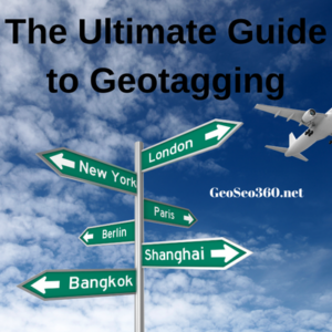
Introduction
In the digital era, photos are more than just images—they’re powerful storytelling tools enriched with metadata. One of the most valuable pieces of metadata is geotagging, which embeds geographical coordinates into a photo’s EXIF data. Whether you’re a travel blogger, real estate agent, or business owner, geotagging helps organize, promote, and verify the locations where your photos were taken.
But how exactly does geotagging work? What are the best tools and techniques for accurate geotag allocation? And how can you optimize this process for better visibility and engagement? In this comprehensive guide, we’ll explore everything you need to know about geotagging—from manual methods to automated solutions like Geoseo360.net.
What is Geotagging?
Geotagging is the process of attaching GPS coordinates (latitude and longitude) to a digital photo. This data is stored in the Exchangeable Image File Format (EXIF), which modern cameras and smartphones automatically record if location services are enabled.
Why is Geotagging Important?
- Improved Organization: Easily sort and search photos by location.
- Enhanced SEO: Geotagged images rank better in local search results.
- Social Media Engagement: Platforms like Instagram and Facebook use geotags to boost discoverability.
- Verification & Trust: Businesses and journalists use geotags to prove authenticity.
The Ultimate Guide to Geotagging
Methods for Allocating Geotags to Photos
There are several ways to add or edit geotags, depending on your device and workflow.
1. Automatic Geotagging (Smartphones & DSLRs with GPS)
Most modern smartphones automatically geotag photos if location services are enabled. Some high-end DSLRs also have built-in GPS for real-time geotagging.
Pros:
- No manual work required.
- Highly accurate if GPS signal is strong.
Cons:
- Drains battery life.
- Privacy concerns if sharing sensitive locations.
2. Manual Geotagging (Using Software & Online Tools)
If your device doesn’t support GPS or you need to correct location data, you can manually add geotags using:
A. Desktop Software
- Adobe Lightroom: Allows batch geotagging via map integration.
- Google Earth Pro: Export location data and sync with photos.
- ExifTool: A command-line tool for advanced users.
B. Online Geotagging Tools (Geoseo360.net)
For a hassle-free experience, web-based tools like Geoseo360.net offer:
- Drag-and-drop geotagging
- Batch processing (ideal for large photo sets)
- Interactive maps for precise location pinning
Why Geoseo360.net Stands Out:
✔ No software installation needed.
✔ Supports multiple image formats (JPEG, PNG, RAW).
✔ Preserves original image quality.
3. Geotagging via External GPS Loggers
For professional photographers, a dedicated GPS logger (like Garmin or Sony GPX devices) records location data separately. Later, you can sync the log file with your photos using software like Lightroom or Geosetter.
Best for:
- Drone photography
- Wilderness expeditions
- High-volume shoots without smartphone GPS
How to Geotag Photos Using Geoseo360.net (Step-by-Step)
Let’s walk through the process of allocating geotags with Geoseo360.net:
Step 1: Upload Your Photos
- Visit Geoseo360.net.
- Drag and drop your images or click “Upload” to select files.
Step 2: Pin Locations on the Map
- Use the interactive map to find your desired location.
- Alternatively, enter latitude/longitude manually.
Step 3: Apply Geotags
- Select the photos you want to tag.
- Click “Add Geotags” to embed coordinates into EXIF data.
Step 4: Download Geotagged Photos
- Once processed, download the images with updated metadata.
Pro Tip: For batch processing, upload a GPX file (from a GPS device) to auto-tag multiple photos at once.
Best Practices for Accurate Geotagging
To ensure your geotags are precise and useful, follow these guidelines:
1. Verify Coordinates Before Tagging
- Cross-check with Google Maps or OpenStreetMap.
- Avoid tagging private or sensitive locations (e.g., military sites).
2. Use Consistent Naming & Tagging
- If tagging for business, include city/landmark names in filenames.
- Example: “Paris_EiffelTower_001.jpg” instead of “IMG_001.jpg.”
3. Optimize for SEO & Social Media
- Geotagged photos rank higher in Google Images for local searches.
- On Instagram, use location stickers to increase reach.
4. Remove Geotags When Necessary
- Before sharing personal photos, strip GPS data using:
- Windows: Right-click > Properties > Remove Location Info.
- Mac: Preview > Tools > Show Inspector > GPS tab > Delete.
Common Geotagging Mistakes to Avoid
Even experienced users make these errors:
❌ Incorrect Time Zone Settings → Misaligned GPS logs.
❌ Tagging Approximate Locations → Reduces credibility.
❌ Overlooking Privacy Risks → Exposing home/work addresses.
Final Thoughts: The Power of Geotagging
Geotagging transforms ordinary photos into location-aware assets, enhancing organization, marketing, and storytelling. Whether you’re a traveler documenting adventures or a business boosting local SEO, tools like Geoseo360.net simplify the process without technical hassle.
By mastering geotag allocation—through automatic, manual, or hybrid methods—you unlock new opportunities for engagement and visibility. So next time you snap a photo, remember: where it was taken is just as important as what’s in the frame.
Now, armed with this knowledge, go ahead and geotag with confidence! 🌍📸