
How to Make Geotag Photos Online with Geoseo360.net
In today’s digital age, geotagging has become an essential tool for photographers, travelers, and businesses alike. Geotagging allows you to add geographical information to your photos, making it easier to organize, share, and locate them on a map. If you’re looking for a reliable and user-friendly platform to geotag your photos online, Geoseo360.net is an excellent choice. In this article, we’ll explore how to make geotag photos online using Geoseo360.net and why this platform stands out in the world of geotagging.
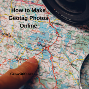
What is Geotagging?
Geotagging is the process of adding metadata to a photo, which includes the geographical coordinates (latitude and longitude) of where the photo was taken. This information is embedded into the photo’s EXIF data, allowing it to be displayed on maps or sorted by location. Geotagging is particularly useful for travel bloggers, real estate agents, and businesses that want to showcase their locations visually.
Why Use Geoseo360.net for Geotagging?
Geoseo360.net is a powerful online tool designed to simplify the geotagging process. Whether you’re a professional photographer or a casual user, this platform offers a range of features that make geotagging quick and efficient. Here are some reasons why Geoseo360.net is a top choice:
- User-Friendly Interface: The platform is designed with simplicity in mind, making it easy for users of all skill levels to geotag their photos without any technical expertise.
- High Accuracy: Geoseo360.net uses advanced algorithms to ensure that the geographical data added to your photos is precise and reliable.
- Batch Processing: You can geotag multiple photos at once, saving time and effort.
- Compatibility: The platform supports a wide range of image formats, ensuring that you can work with your preferred file type.
- Privacy and Security: Geoseo360.net prioritizes user privacy, ensuring that your photos and data are safe and secure.
How to Geotag Photos Online with Geoseo360.net
Geotagging your photos with Geoseo360.net is a straightforward process. Follow these steps to get started:
Step 1: Visit Geoseo360.net
Open your web browser and navigate to Geoseo360.net. The website’s clean and intuitive interface will greet you, making it easy to find the tools you need.
Step 2: Upload Your Photos
Click on the “Upload Photos” button to select the images you want to geotag. You can upload individual photos or use the batch upload feature to process multiple images simultaneously.
Step 3: Add Geographical Information
Once your photos are uploaded, you’ll be prompted to add the geographical coordinates. You can either manually enter the latitude and longitude or use the interactive map provided by Geoseo360.net to pinpoint the exact location.
Step 4: Apply Geotags
After specifying the location, click on the “Apply Geotags” button. The platform will automatically embed the geographical data into the EXIF metadata of your photos.
Step 5: Download Your Geotagged Photos
Once the geotagging process is complete, you can download the geotagged photos to your device. The images are now ready to be shared, uploaded, or used in your projects.
Tips for Effective Geotagging
To make the most of Geoseo360.net and ensure accurate geotagging, consider the following tips:
- Double-Check Coordinates: Always verify the latitude and longitude before applying geotags to avoid errors.
- Use High-Quality Photos: Geotagging works best with high-resolution images, as they provide more detail and clarity.
- Organize Your Photos: If you’re working with multiple images, organize them by location to streamline the geotagging process.
- Respect Privacy: Be mindful of privacy concerns when geotagging photos, especially if they include sensitive or private locations.
Applications of Geotagged Photos
Geotagged photos have a wide range of applications, including:
- Travel Blogging: Share your travel experiences by showcasing the exact locations of your photos.
- Real Estate Marketing: Highlight properties with geotagged images to provide potential buyers with a clear sense of location.
- Event Documentation: Geotag photos from events to create a visual map of the occasion.
- Tourism Promotion: Use geotagged images to promote tourist destinations and attractions.
Geotagging your photos is a simple yet powerful way to enhance their value and usability. With Geoseo360.net, the process becomes even more accessible, thanks to its user-friendly interface, high accuracy, and robust features. Whether you’re a professional or a hobbyist, this platform offers everything you need to geotag your photos online efficiently. So, the next time you want to add a geographical context to your images, give Geoseo360.net a try and experience the convenience of seamless geotagging.
By leveraging the power of geotagging, you can transform your photos into dynamic, location-aware assets that tell a richer story. Start your geotagging journey today with Geoseo360.net and take your photography to the next level!